Download this How To page by : the Adobe Reader URL in the top right corner of this page:
Definitions | Getting Started | Area of Interest | Search and Zoom
Definitions
The following is a description of several complimentary ways of searching for a specific locations in Alberta (like your farm) that are represented in the mapping area of the Alberta Soil Information Viewer and then Centering the mapped area of the viewer at this specific location, and then increasing the magnification at this location. This process is commonly known as “searching and zooming to” a specific location in the mapping area of the viewer.
The mapping area of the viewer is where spatial information like:
- Digital soils information [e.g. The Agricultural Regions of Alberta Soil Inventory Database (AGRASID);
- Color Infrared composite Satellite image mosaics and Orthographically rectified aerial photography (ORTHOPHOTO) mosaics; a mosaic is a patch work of the best, most cloud free imagery of a certain type over a finite period of time like a summer growing season stitched together over a large geographic region (like the Province of Alberta or agricultural area of the province).
- Municipality, city, town, village features;
- Water, roads, other utility features.
- Federal and provincial land, and legal land description boundaries.
- Geographic coordinates from internet mapping websites, global positioning system (GPS) or from paper maps that define specific locations (well sites or towers, gate locations), linear features such as a fence lines or shelter belts, or area features like a field, feeding pen, dugout, or silage pit that are enclosed by the Alberta provincial border.
Geographic features in the Alberta Soil Information Viewer are defined by one or a group of latitude and longitude coordinate pairs such as: 51.23801, -113.94100 where the first number of the coordinate pair is the latitude value expressed as a positive decimal degree value, and a second number is the longitude value expressed as a negative decimal degree value in the geographic space that the Alberta boundary encloses on the nearly spherical shape that represents the earth’s surface.
Go to the Welcome Page | Go to the top of this page
Getting Started
In order to get started please read the how to Get Started tip sheet available at the Alberta Soil Information Viewer welcome page, or:
1. "Right Click and Open in New Tab" the Online Soil Viewer uniform reference locator (URL) or click on the graphic:
 In the top left area of the Alberta Soil Information Viewer welcome page. In the top left area of the Alberta Soil Information Viewer welcome page.
2. Left mouse click or tap the  button to get started working in the Alberta Soil Information Viewer environment. button to get started working in the Alberta Soil Information Viewer environment.
3. Left mouse click or tap the maximize viewer button  in the top right corner of banner for the viewer. in the top right corner of banner for the viewer.
Go to the Welcome Page | Go to the top of this page
Area of Interest
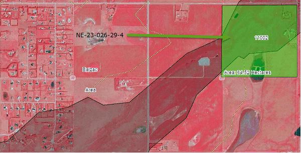
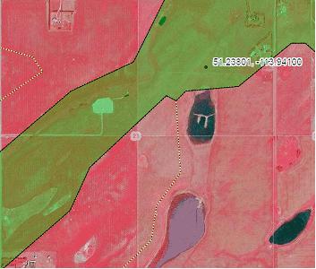
For the purposes of this “How To” the area of interest is Agricultural Regions of Alberta Soil Inventory Database (AGRASID) polygon 11002, north east section 23 township 26 range 29 west of 4 (NE-23-026-29-4) (east of “Balzac”, the geographic coordinates area 51.23801, -113.94100.
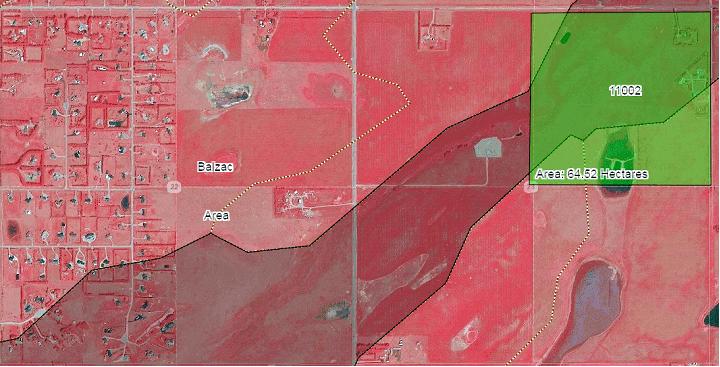
Figure 1: AGRASID Soil Polygon ID = 11002, on ne-23-026-29-4, north east of the Balzac viewed with a 150 centimeter pixel resolution false color infrared composite SPOT 2015 satellite image backdrop as the base map.
Go to the Welcome Page | Go to the top of this page
Search and Zoom
By place name | By legal land descriptor | By polygon id | By real time GPS | By latitude and longitude coordinate pairs | By bookmark
By place name
1. Enter “Balzac” in the search box located in the top right area of the viewer, and

2. Left click, tap the magifying glass icon to begin the search. Tapping the “done” button , or pressing enter key if available. will also initiate the search.
3. Holding the left mouse button or making contact with the screen drag and move the map area so that area of interest is centered in the map area. Each Township in the mapped area will have a label  and each Section has a label as well that is in the center of the section of interest. Quarter sections NW, NE, SW, and SE are inferred by the quarter section line work that is layered on top of each section polygon. and each Section has a label as well that is in the center of the section of interest. Quarter sections NW, NE, SW, and SE are inferred by the quarter section line work that is layered on top of each section polygon.
4. Open the bookmark window  and press the “Create” and press the “Create”  button to create a “by place name” bookmark by: button to create a “by place name” bookmark by:
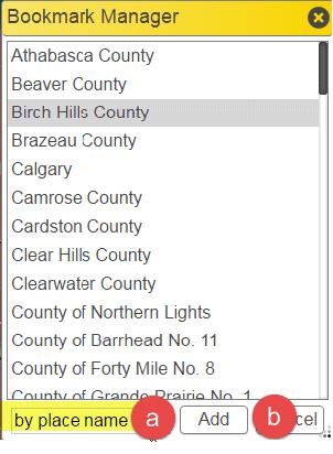
5. Left click, tap the full extent icon 
Go to the Welcome Page | Go to the top of this page | Go to top of the section
By legal land descriptor
1. Enter the legal land description for the parcel of interest north east section 23 township 26 range 29 west of 4 (NE-23-026-29-4):

2. Left click, tap the magifying glass icon to begin the search. Tapping the “done” button , or pressing enter key if available. will also initiate the search.
3. When the search is complete the map area of the viewer should be situated close to the north east section 23 township 26 range 29 west of 4 quarter section:
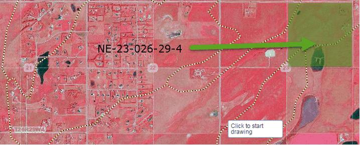
4. Open the bookmark window  and press the “Create” and press the “Create”  button to create a “By Legal Land” bookmark by: button to create a “By Legal Land” bookmark by:
5. Left click, tap the full extent icon 
Go to the Welcome Page | Go to the top of this page | Go to top of the section
By Soil Polygon ID Number
1. Another form of search is by AGRASID polygon number value. Enter the soil polygon number (11002) into the search box for the dominant soil polygon in the north east section 23 township 26 range 29 west of 4 quarter section.

2. When the search is complete the map area of the viewer zoomed close to the AGRASID polygon number (Polygon ID= 11002):
3. Open the bookmark window  and press the “Create” and press the “Create”  button to create a “By Soil Polygon ID” bookmark by: button to create a “By Soil Polygon ID” bookmark by:
4. Left click, tap the full extent icon 
Go to the Welcome Page | Go to the top of this page | Go to top of the section
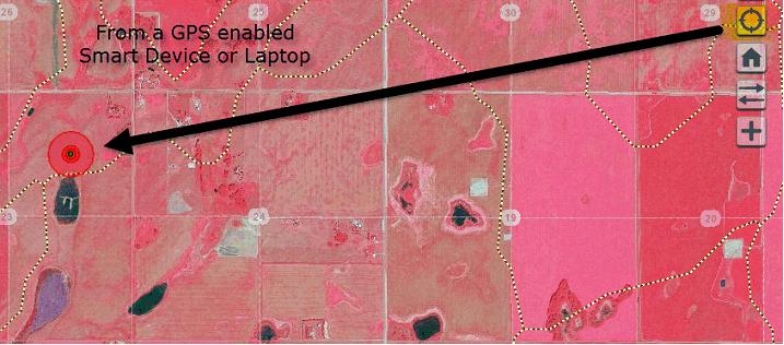
By Real Time GPS coordinate on a GPS enabled smart device
If a GPS receiver is built into or attached as a peripheral to the same computing or smart device being used to view the Alberta Soil Information Viewer. The viewer will search and zoom (magnify) to the real time location of the GPS enabled smart device by left clicking or tapping the locate position icon . .
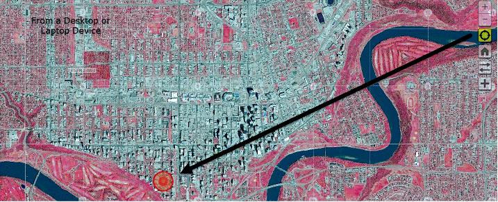
Non GPS enabled desktop and laptop devices search and zoom to the approximate location of the origin of the internet service provider’s origin of broadcast.
1. There is currently no “automated” way of capturing the associated geographic coordinate pair at the location where the smart device is situated.
2. A process for manually acquiring a latitude and longitude geographic coordinate pair is described in steps 2 and 3 of the next section and may be used to acquire credible coordinates for the current smart device location or any other location in the mapping area of the Alberta Soil Information Viewer.
Go to the Welcome Page | Go to the top of this page | Go to top of the section
By latitude and longitude coordinate pairs
Another form of search is by Geographic Coordinate pairs.
1. A geographic coordinate pair may come from a global positioning system (GPS) device 
2. If there is a GPS receiver is built in or attached as a peripheral of say a laptop the Alberta Soil Information Viewer:
a.  Left mouse click or tap the “locate position” icon. Left mouse click or tap the “locate position” icon.
b. The Viewer searches and zooms (magnifies) to the current location of the GPS enabled smart device, and
c. Displays this location within the Alberta Soil information Viewer as a series of three red circles centered on the current location of the GPS enabled laptop or smart device.
d. Hovering the cursor or touching the screen over any location in the mapped area of the Alberta Soil Information viewer (in this case the current location of the GPS enabled laptop or smart device):
3. It is possible to manually record a credible latitude and longitude coordinate pair from the Latitude (Lat:) and Longitude (Long: ) cursor or touch display in the bottom right corner of the mapped area of the viewer.
4. Best results occur when the scale of the mapping area of the viewer is magnified or zoomed to a scale of 1:10, 000 or less.
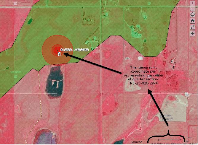
6. Latitude and Longitude coordinate pairs may also be gathered from a paper map of sufficient precision (scale) or a third party mapping application or web application.
7. Enter the geographic coordinate pair for the center of the north east section 23 township 26 range 29 west of 4 (NE-23-026-29-4 51.23801, -113.94100 ):

8. When the search is complete, the map area of the viewer should be situated close to the entered geographic coordinate pair:
9. Open the bookmark window  and press the “Create” and press the “Create”  button to create a “By Lat and Long” bookmark by: button to create a “By Lat and Long” bookmark by:
10. Left click, tap the full extent icon 
Go to the Welcome Page | Go to the top of this page | Go to top of the section
By Bookmark
The final way to search and magnifying (zooming) is by:
- Pre-defined county and municipality boundaries as of the fall season of 2016 or
- Custom created bookmarks such as the one custom created book marks created throughout previous sections of this document.as of the fall of 2016 or by a custom created bookmark.
This form Bookmark directed searching and zooming is accomplished by:
1.  Left mouse clicking or tapping on the “open bookmark manager window” icon. Left mouse clicking or tapping on the “open bookmark manager window” icon.
2. The Balzac area of interest NE-23-026-29-4, Polygon ID 11002, Lat: Long: pair 51.23801, -113.94100 is situated within the boundaries of “Rocky View County”.
a. “Left mouse click” and
b. press the “Go button”  or or
c. Double tap to select the “Rocky View County” predefined bookmark or one of the custom created bookmarks:
From the “Bookmark Manager” window:
| Pre-Defined Bookmarks | Custom Created Bookmarks |
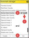 | 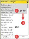 |
The Result is that the mapped area of the viewer searches and zooms (magnifies) to the extent of the boundary of the “Rocky View County” border or to the extent and scale of the view area the custom created bookmark was created.
Go to the Welcome Page | Go to the top of this page | Go to top of the section
For further details of other tasks such as how to: “Run the Viewer” return to the Alberta Soil Information Viewer Welcome Page and browse the “Read How to:” or “Watch How to: ” sections of the welcome page.

Contact the Ag-Info Centre, toll-free in Alberta at 310-FARM (3276), for further soil viewer and agricultural information.
12132016 |